MapLoup: a predation monitoring and analysis portal for livestock farmers and local stakeholders
MapLoup is a predation data portal with an online visualisation interface. Created in 2019 in the Auvergne-Rhône-Alpes region by the Pastoral Network Auvergne-Rhône-Alpes, it provides livestock farmers and shepherds, technicians and policy-makers with clear, reliable and fast real-time access to data on wolf predation. The platform is operated by the pastoral services and INRAE in Grenoble.
An overview of predation for professionals faced with the problem
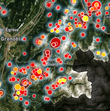
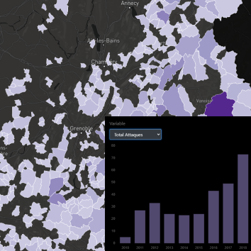
The MapLoup portal provides both a near-real-time and long-term overview of predation at various administrative levels, from regional to local. The portal includes data during the season, linked to reports, to keep up to date with predation, and also provides consolidated ‘à la carte’ data in the form of graphs and tables to analyse changes in predation at various levels. The system has been extended over the years to cover a large part of the Alps and the Auvergne-Rhône-Alpes region.
The originality of this tool lies in the existence of an alert system when a suspected attack is entered on the map, a feature that is particularly appreciated by professional users. This provides rapid information, enabling neighbouring livestock farmers to be better prepared and local policy-makers to be aware of developments within their area. To date, more than 2,300 people have signed up for text message or email alerts.
The system provides partners with mapped and quantified information over a 14-year period (2010-2023). All of this will facilitate a joint analysis of predation and will feed into initiatives and processes to support farmers and shepherds.
Raw data provided by public authorities
The data comes from two sources:
- For the Atlas, the data comes from the national Géoprédateur file, which lists recorded attacks for which compensation has been awarded. This data is provided anonymously by the Auvergne-Rhône-Alpes Regional Department for the Environment, Planning and Housing.
- For the MAP section, data is provided to the pastoral services by the Departmental Directorate of Territories at the time of the report request by livestock farmers that have been the target of predation.


An ever-improving web platform
Pastoral Services launched a major survey in 2021 to gather user experience. More than 400 people responded, expressing their interest in the platform. Among the suggestions made by respondents, a number of improvements have been made over the years:
- With regard to the origin of the data and how to use it, a Frequently Asked Questions section has been created to answer the most common questions.
- As regards the precision of the place of attack, a precision status has been added to MAP. It is now possible to tell whether the location accuracy is reliable or approximate.
- With regard to on-screen display, filters can now be used to filter by department or species.
- With regard to the protection of personal data, INRAE Grenoble has taken all the necessary measures to make the platform ‘RGPD compliant’.